Newtown Creek Watershed Protection Plan
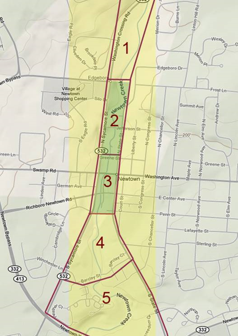
Establishing Zones
In order to inform the public about the creek and solicit feedback on the zone plan and recommendations for future improvements, the NCC staged public presentations in April 2009 and March 2010. These presentations provided background on the cultural and natural history of the Newtown Creek and Common, the creek zones as they exist today, and an overview of waterfront development precedents in other locations. The presentations were followed by feedback sessions that invited attendees to post their visions about what should be changed or preserved along the creek. The feedback from these meetings was incorporated into the watershed plan for the creek drafted by the Heritage Conservancy.

Zones
Headwater Zone
source to Frost Lane (added 2010)
1 Dam to Frost Lane
flood management & riparian habitat
2 Frost to Greene
pedestrian crossings, low impact planting
3 Greene to Penn
increase visibility of village waterfront as placemaking element for business district
4 Penn to Barclay
Delta property & Stockburger property (now Steeple View property)
5 Barclay to Bypass
creek walk, connect to overpass, trail
Confluence Zone
bypass to Neshaminy Creek (added 2010)
